
Millburn ZIP Codes by Area
Millburn Township uses two documented ZIP codes: 07041 for Millburn and 07078 for Short Hills. The township's historic-preservation material identifies Millburn Center, Wyoming, and South Mountain as Millburn areas, while Short Hills includes Knollwood, Glenwood, Brookhaven, Country Club, White Oak Ridge, Old Short Hills, Deerfield-Crossroads, Mountaintop, and Merrywood. Those are useful community descriptions, not surveyed postal lines. The research did not locate an official block-level boundary map for either ZIP.
| ZIP | Areas Covered | Post Office | Notes |
|---|---|---|---|
| 07041 | Millburn postal community, generally Millburn Center, Wyoming, and South Mountain in local descriptions | Millburn Post Office, 300 Millburn Avenue, 973-376-2966 | Exact neighborhood and block boundary was not located; confirm a street number with USPS |
| 07078 | Short Hills postal community, including the named Short Hills sections in local descriptions | Short Hills Post Office, 30 Chatham Road, 973-379-5214 | Short Hills is an unincorporated Millburn Township community, not a separate municipality |
The Millburn post office lists retail hours of 9:00 a.m. to 4:30 p.m. on weekdays and 9:00 a.m. to noon on Saturday. The Short Hills post office lists 9:00 a.m. to 5:00 p.m. on weekdays and 10:00 a.m. to 4:00 p.m. on Saturday. Hours should be checked with USPS before an in-person visit. Postal delivery labels are not legal municipal boundaries, and the table should not be used to infer a boundary from a neighborhood name alone.
Millburn ZIP Code Postal Labels
Short Hills is the important local distinction. It is an unincorporated community within Millburn Township, even though a mailing address can read “Short Hills, NJ 07078.” Tax, land, and court research should retain Millburn Township and municipality code 0712 alongside the postal label. A street address can also carry a community name that is not the legal jurisdiction used by a property record or court system.
Old roads make that distinction more useful. Parsonage Hill Road, Old Short Hills Road, Hobart Avenue, Millburn Avenue, and Main Street follow older routes identified in the historic plan. Wyoming has a more regular historic grid, South Mountain has winding roads shaped by the Rahway branches, and Short Hills includes winding and sloped development sections. When an old address does not resolve, preserve the exact historic label and use the parcel block and lot rather than assuming that a current mail label explains the entire location.
Millburn ZIP History Has No Split
The reviewed local and state sources did not document an additional Millburn ZIP, a PO-box-only ZIP, a single-institution ZIP, a ZIP split, or a realignment year. They also did not provide an official block-level map that draws the 07041 and 07078 division. That absence is a research limit, not a reason to make a boundary claim from a neighborhood name, an old directory heading, or a nearby address.
USPS's Postmaster Finder can help with a historical postal-name question. Its historical route accepts beginning and ending three-digit ZIP ranges and returns ZIP, post office, state, establishment date, and discontinuation date, with a warning that older information may be outdated. It can place a post office in postal history, but it cannot establish the legal municipal location of a parcel. For an old Millburn address, keep the historic street label, the Township parcel identifiers, and the current USPS result together.
Millburn ZIP Code Lookup Fields
Use the official USPS ZIP Code Lookup for a particular delivery address. It offers three modes: By Address, By City and State, and Cities by ZIP. By Address is the right choice when a street number is already known. Its result standardizes the postal address. It does not prove that a person or company lives there, and a multiple-match result should be narrowed with the street and unit information.
| Field or mode | Requirement | Verified use |
|---|---|---|
| Company | Optional | Available in By Address mode |
| Street Address | Required | Primary address input for a postal match |
| Apt/Suite/Other | Optional | Use to narrow a multi-unit address |
| City, State, ZIP Code | Optional in By Address mode | Additional location inputs when available |
| By City and State | City and state required | Returns postal information by place name |
| Cities by ZIP | ZIP required | Returns city information associated with the ZIP |
The USPS lookup interface displays the address, city-and-state, and ZIP search paths used for postal standardization.
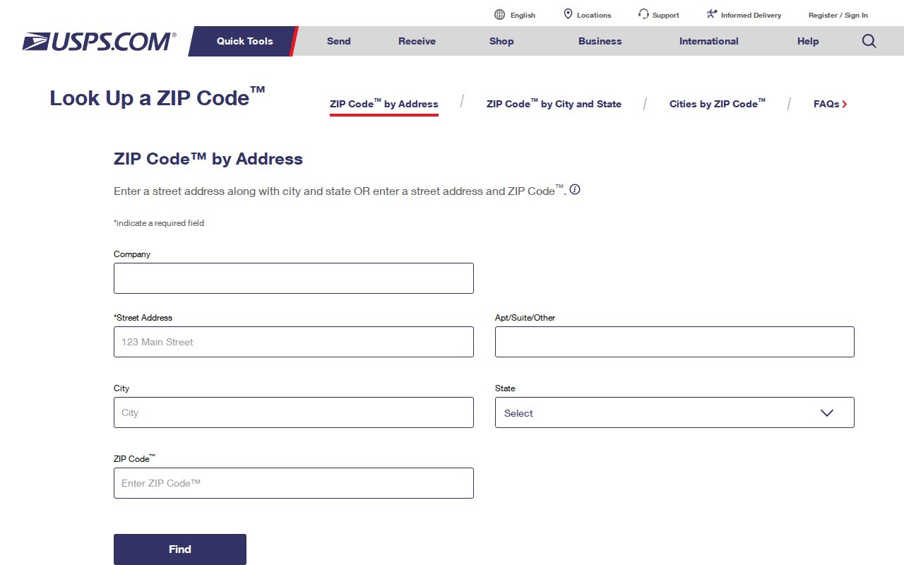
The standardized output is a check on postal formatting. It is not a resident roster, a municipal-boundary decision, or a substitute for a property record.
Finding Millburn Records by ZIP
A ZIP can narrow an address question, but the researched Millburn record systems do not provide a verified ZIP-wide resident list. Start with USPS to confirm the exact postal form, then switch to the key accepted by the local record keeper. The Township Property Record Card route uses street address, owner name, or block and lot. Essex PRESS uses municipality, block and lot, name, document type, and date. The statewide voter status tool is not a public ZIP directory, and its detailed current field display was not captured in official text.
- Enter the full known street address in USPS By Address and save the standardized postal result.
- Use the resulting street address, not the ZIP alone, in the Township assessor's Property Record Card route or with the assessor's office.
- Record the Millburn Township block, lot, qualifier, situs address, and tax mailing address from the parcel record where available.
- Search the Essex Register's PRESS system by Millburn municipality and block and lot when a recorded transaction is relevant.
- Ask Essex election officials for the current lawful voter-list request procedure before expecting any ZIP-based extract; the form, fee, delivery method, and permissible fields were not located.
The Millburn Tax Assessor links to the current Property Record Card service. Once a ZIP has narrowed an address, the Millburn street-address directory gives the address-first record trail. It is the better route for a named street because the local systems are parcel- and address-keyed, not ZIP-keyed.
Note: A postal match is a starting point for an address search, not evidence of every person associated with that street.
Millburn ZIP Search Limits
ZIP filtering is uneven across the local tools. USPS accepts ZIP directly. Rutgers MOD-IV HDB offers municipality, block and lot, address, class, exemption, year, and other assessor attributes, but a ZIP filter was not independently confirmed. The Millburn Property Record Card's exact ZIP control did not render during research. PRESS has no verified ZIP filter, and the SDL permit route searches owner, address, or parcel instead. A precise ZIP cannot turn those systems into a list of households.
The Rutgers MOD-IV HDB is useful as a statewide assessment cross-check. It covers annual data from 1989 through the latest certified year, with municipality and property-oriented search dimensions. Public owner-name searching was removed from the HDB after Daniel's Law, so the locally linked assessor service and the assessor office remain important for current parcel work.
The MOD-IV search interface presents the confirmed municipality, block/lot, address, class, exemption, and year filters.
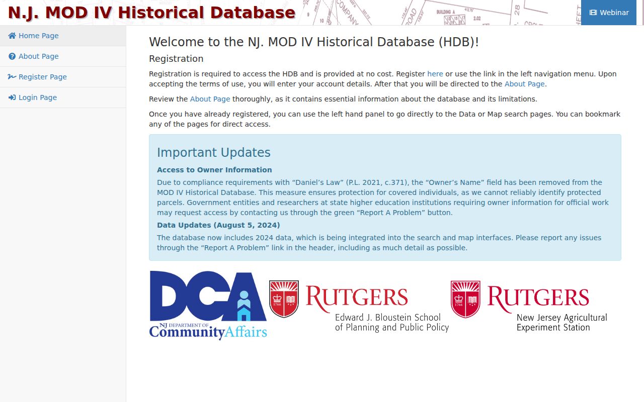
Its visible property filters help cross-check a parcel once an address is known, while the unverified ZIP control remains a limitation rather than a claimed search feature.
Millburn ZIP Records Use Four Addresses
One Millburn property can carry several valid address fields. Keeping them separate prevents the common mistake of treating the Short Hills postal label, the assessor tax-mail address, and the physical parcel as interchangeable. A named person may be connected to one field but not another, especially when an entity, representative, or later transaction is involved. The legal description is often more stable than a street label when a road, subdivision, or postal name has changed.
- Situs address
- The physical parcel location used by the assessor, tax maps, permits, and related property work.
- Tax mailing address
- The destination for assessment and tax correspondence. It may be outside Millburn or identify an entity or representative.
- Grantee mailing address
- The contact address shown on a recorded deed's cover-sheet information at the time of recording.
- Postal address
- The USPS delivery format, including ZIP and postal city. “Short Hills” is a postal community within Millburn Township.
- Legal description
- The recorded block, lot, qualifier, subdivision or map reference, or metes-and-bounds wording that identifies the property in an instrument.
Use the full four-field note before comparing a parcel card, recorded document, service record, or old directory. A tax mailing field is a correspondence destination, not proof of occupancy. The research also found no verified local ZIP split, realignment, PO-box-only ZIP, unique ZIP, or official ZIP boundary map to add another shortcut.
Millburn ZIP Codes and Township Limits
ZIP boundaries and municipal boundaries answer different questions. The USPS label tells the Postal Service how to format delivery. Millburn Township records use the township, parcel identifiers, and legal descriptions. Because the exact 07041 and 07078 local division was not found in an official block map, verify a particular number through USPS rather than drawing a line from a community name or a nearby address. The historic-preservation material documents the two ZIPs but does not establish every street-level assignment.
- ZIP+4
- An added four-digit delivery detail used with a five-digit ZIP. No local ZIP+4 pattern was documented as a Millburn record-search field.
- PO-box ZIP
- A ZIP assigned for post-office boxes rather than ordinary street delivery. No local PO-box-only ZIP was located in the reviewed sources.
- Unique ZIP
- A ZIP associated with one institution or organization. No Millburn unique ZIP was located in the reviewed sources.
- Carrier route
- A Postal Service delivery sequence used for mailing operations. No locally documented carrier-route search was found for the resident-record tools.
The USPS Postmaster Finder can answer a historical postal-name question with ZIP, post office, state, establishment, and discontinuation details, although USPS warns that historical information may be outdated. It does not establish the legal location of a particular parcel. No verified township-wide readdressing or ZIP realignment schedule was located; the Historical Society's 1949 proposed Essex Street change is map context, not proof of a ZIP change.
Note: When a ZIP and a township record seem to disagree, preserve both values and verify the individual address with the relevant custodian.